GOLDEN, Colo., Aug. 17, 2020 /PRNewswire/ — To help geologists and engineers manage, display and analyze surface and sub-surface data, RockWare announces the release of RockWorks 2020, the latest version of its flagship suite.
According to the company, the new version provides the following improvements:
Interface
- Redesigned RockWorks screen layout.
- Redesigned program windows – tabbed settings make it much easier to navigate each program’s options.
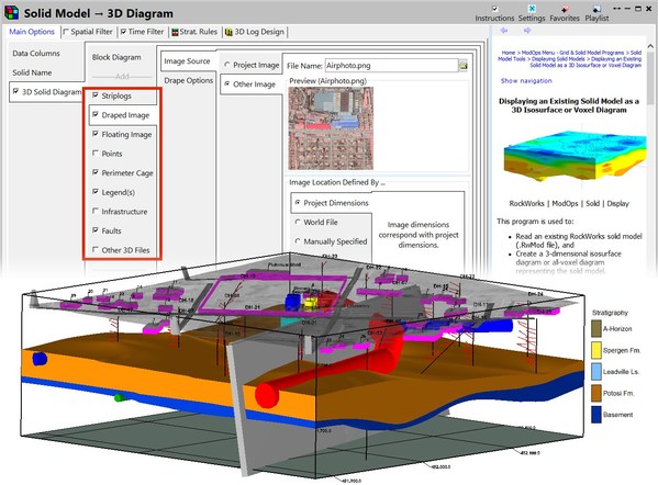
- Greatly expanded graphic annotations – add layers with north arrows, legends, land grids, other maps, existing graphics, and much more as you build your new 2D and 3D diagrams.
General functionality
- New Playlist for easy automation – just click a button to add a program to a Playlist. Then, just click a button to run your Playlist to create models, maps, diagrams while you have lunch. Available for Basic (5 items), Standard (5 items), and Advanced (unlimited items).
- New RockWorks Command Scripting for Advanced users – start with a Playlist and go for it!
- New Favorites list – just click a button to add a program to a list of your commonly-used programs.
- New Search tool – type in a search term and see a list of applicable programs.
- Automated licensing – Single and Annual licenses can be activated/deactivated automatically, right within RockWorks.
Data
- Compare databases – get a quick and easy report of differences between borehole data in different projects.
- Updated coordinate conversions.
- Automated Example files – click the Example button in many program windows to load a sample Datasheet file for layout reference.
- New Faults tab – define multiple fault locations and orientations for your project, and apply them to models, maps, sections. Available for Basic (3 faults), Standard (3 faults), and Advanced (unlimited faults).
Modeling and Display
- Automated T-Data Modeling over time.
- Automatic polygon clipping – no need to define your own polygons, RockWorks can define one automatically bounding the input data locations.
- New animation programs.
- RockWorks includes multiple modeling algorithms, 2D & 3D visualization, volumetrics, and analyses for applications within the following markets;
- Academic Research
- Archeology
- Civil / Geotechnical Engineering (Tunneling, Site Characterization & Remediation)
- Environmental Studies (Contamination Modeling)
- Geothermal
- Hydrology & Hydrogeology
- Mining (Base & Precious Metals, Coal, Coal Bed Gas Methane, Industrial Minerals, and Uranium)
- Oil & Gas Exploration & Production
For complete information, visit www.rockware.com
Photo – https://mma.prnasia.com/media2/1227711/rockware_rockworks.jpg?p=medium600
Contact:
t: 800.775.6745 // f: 303.278.4099 //
Related Links :